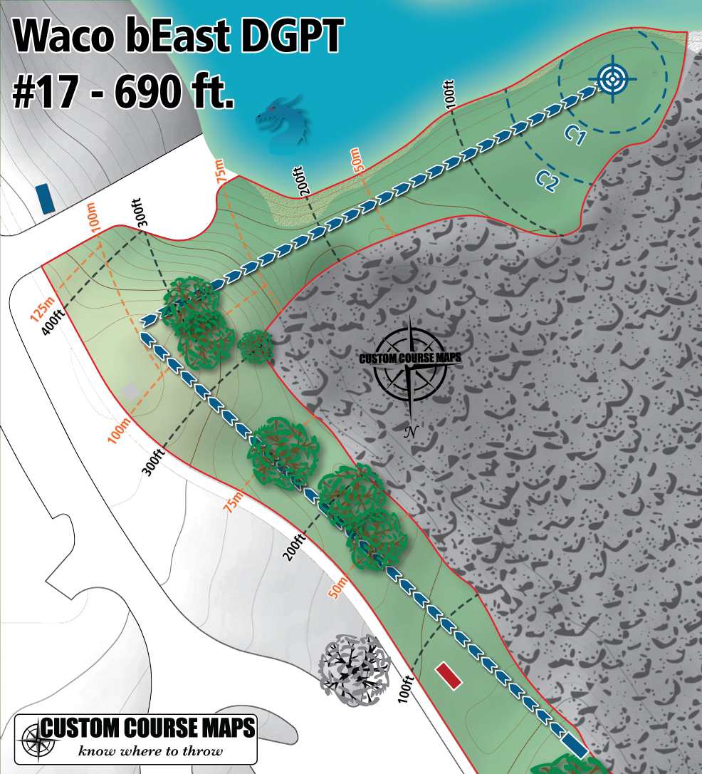
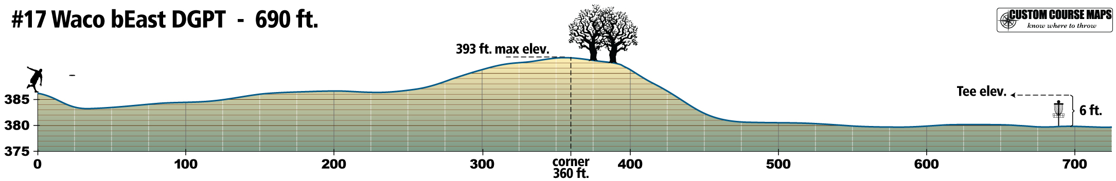
The pandemic has reshaped how we get work done without the need to be physically present at the job site. However, before the big switch to working remotely began, there were many employees working in fields where the job could be completed from a different location. One of those fields is Geographic Information Systems (GIS) which utilizes remote sensing as a means to collect data at one site and process at another. Over the past few years I have been using this technique to create maps of disc golf courses I have never visited. Often I would seek the challenge of tracking down the data and creating a highly detailed and accurate map of a single hole or a complete course in order to highlight a particular feature. These practice maps were created to show to emphasize terrain. Elevation data is becoming more plentiful but often left out of maps provided at major tournaments. Yet, during the coverage of the competition, the video hosts often mention how terrain is effecting the play while at the same time it is difficult to visualize in the footage. Adding terrain info to a map gives a more realistic depth to the base layer while working with software that provides geo-referencing allows real world measurements to be added as well.
The following images were created entirely at my home in Saint Paul, Minnesota. Multiple sources were used including leaf-off aerial imagery, drone footage, video footage and high resolution digital elevation models…all publicly available through the internet.