During the PDGA Masters Worlds Championships two of the rounds for Pool A as well as the semifinals and finals for all divisions were played at Waterworks Park in Kansas City. The park is very hilly yet no elevation information was provided during the tournament so I mapped it out after having a discussion with another player about the elevation drop on hole #1. (scroll below the table to see how it was done)
The table shows the change in feet for each hole and a summary of how many holes gain or lose elevation as well as the total up and down. Hole 12 used a different pin position for the final 9, This shorter hole is not included in the summary.
| Hole | Elev. Change |
| 01 (Final #6) | -65 |
| 02 | +21 |
| 03 | -19 |
| 04 | 0 |
| 05 | -1 |
| 06 | +10 |
| 07 (Final #7) | +31 |
| 08 | -49 |
| 09 (Final #8) | +15 |
| 10 (Final #9) | +44 |
| 11 | +25 |
| 12 | -9 |
| 12 Short (Final #1) | -2 |
| 13 (Final #2) | +10 |
| 14 (Final #3) | -42 |
| 15 | +15 |
| 16 | -12 |
| 17 (Final #4) | +33 |
| 18 (Final #5) | +37 |
| 10 holes gain elevation | +241 ft. |
| 7 holes lose elevation | -199 ft. |
| 1 has no change |
I recorded the the longitude and latitude of the tees and as many pin positions as I could find after competition concluded each day I was there. I used a consumer GPS with accuracy at about 6ft. The collected waypoints were crossed checked against high resolution aerial imagery to correct for any errors. This step is necessary even though I had an external antenna. The tree cover obscures the signals from satellites and allows the GPS location to drift slightly.
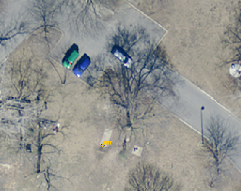

Next, each waypoint was plotted against recently acquired lidar data to determine the elevation. The shadow is almost directly north of the pin and with no leaves on the trees, the image must have been taken close to noon central standard time.